
Support
The aim of this section is to support any user of QGISRed. Although the application is free, it is not unattended. You will find here several levels of help to feel supported in your first steps, and also when you are already a professional in the use of the application.
First of all, we remind you that there is a portal to report any issue observed in the use of QGISRed. Although you have to register beforehand, it is a public portal linked to the development platform on GitHub.
But if you want a more continuous and personalised attention, you can subscribe to the Technical Support Service to have a more immediate response to your problems.
The attention to your needs can go even further, offering a direct Helpdesk for companies under contract. Check the corresponding section, and you will get an idea of the multiple ways in which we can collaborate, so that you can make the most of QGISRed and turn it into your favourite modelling tool.
Finally, our university spirit leads us to propose the preferred form of collaboration on our part, and that is through participation in Research and Development Projects, always seeking to advance to achieve increasingly demanding goals.
Enter and you will know all these proposals in more detail.
Issues
In the Presentation section we have already told you that part of the QGISRed code is public, and is hosted on the GitHub portal https://github.com/qgisred/QGISRed/issues. There we also mentioned the existence of the Issues tab reserved for users to report any incident observed in the use of the application, although in practice some users are also using this section to make suggestions. In the future you will also be able to make suggestions through this web page, and the GitHub portal will be reserved for reporting only issues and bugs encountered in the use of the application.
Below, the QGISRed page on GitHub is shown again, now opened by the Issues tab. Notice that the information is divided in two parts, one related to the Open issues, and the other to the Closed issues. If you enter any of them you can follow the thread of the conversation. In some cases, very interesting information is provided as a result of the issue raised, especially in our replies.
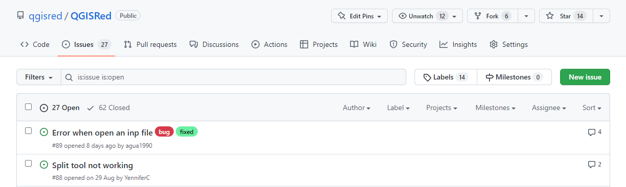
Each Issue has a title and number preceded by a hashtag, and for each one you can also see the date it originated and closed, the users who have participated, and a coloured label that qualifies the type of issue, whether it was a bug or a suggestion, whether it has been resolved, whether it remains for the future, etc. All this can be used to classify the incidents from the buttons on the right, as headers.
To follow the thread of the conversation you just have to enter it and add new messages at the end. You can also create a new issue by clicking on the green New Issue button at the top right. But to actively participate, you must first register on the GitHub project by clicking on the Sign up button at the top right of the window, and fill in the requested data.
Technical support
One of the things that open source applications are often criticised for is the lack of direct user support, as opposed to the advantage of not having to pay licensing fees. Although there is the option of using the incident portal or the user forum, there is no guarantee of a quick and effective response.
However, we can provide a personalised technical support service, with priority response, in exchange for an annual subscription that has yet to be determined. The option of guaranteeing a response to any failure in a short time may encourage any company to adopt QGISRed as its reference product when developing and maintaining network models. If this is your case, you can contact us through the Contact section, to establish the conditions of the support, which would always be done remotely, either by mail, videoconference or remote access.
This support would also include guidance on the best way to address a given problem, but not the analysis of customer data, nor technical help in building the network model, nor the development of specific capabilities requested by customers. These options are also possible and are detailed in the following section, but are subject to our ability to respond at any given time.
Business services
Professor Fernando Martínez, head and director of the QGISRed application, has more than 40 years of experience in the modelling of supply and irrigation networks for many real installations. Some as complex as the supply system for Valencia and its metropolitan area, which supplies 1.5 million inhabitants, and whose Digital Twin is currently a world reference.
All this experience is being used to create the core of the QGISRed application and to give each of its capabilities the greatest possible practical sense.
But, although QGISRed is free, and will surely be used by many engineering companies to offer modelling services to other companies, direct contact with the authors of the application is always a guarantee of success.

The IIAMA can offer a wide range of services to companies managing drinking water supplies.
- To build and calibrate a hydraulic model that faithfully reproduces the behaviour of the network, based on cartographic information, consumption data and field measurements.
- Calibrate a water quality model for the analysis of various operational strategies, in order to control the quality parameters established by the regulations.
- Plan network improvements for the near future, in line with the objectives proposed in the master plans, including sectorisation
- Propose operating strategies for energy saving, or any other objective
- Analyse the integration of renewable energies in the transport and distribution of water through the network.
- To create a Digital Twin of the network, taking into account all the elements inventoried in the GIS.
- Obtain models adjusted to reality for any date by consulting the company’s corporate databases.
- Connect the QGISRed model with the company’s databases to keep the Twin always alive and working in real time.
- Use the Twin for leak detection and location, or detection of any anomalous network performance
- Obtaining simplified models from the Twin for use in optimisation processes
- Use the Twin to perform real-time balancing, or to maintain an always up-to-date indicator system
- Integrate the QGISRed core algorithm in the Company’s data management platform, to give added value to the information simply stored.
- Other services or developments proposed by the company, along the lines of the previous actions.
The contracting of these services will always depend on the group’s capacity to address the proposed challenges, whose main objective for now is to complete the capacities and features of QGISRed, and increase its robustness and scope.
Another way in which our team collaborates with the business environment is by providing technical assistance under contract in the use of QGISRed to consulting companies, which in turn offer their engineering services to other water management companies or directly to end users.
Participation in Projects
Public or private projects are a way of tackling new challenges, with the collaboration of experts in various complementary areas.
In this sense, the IIAMA as a University, and the consultancy firm WaterPi as a private partner, can participate as partners or subcontractors in any local, national or European project, providing experience in the modelling of distribution networks, on the one hand, and on the other the possibility of capturing the results of the project on a platform already operational and free to use, which would immediately make the results of the project available to users.
Moreover, in a research project, the hydraulic model is not normally the end, but rather the means to achieve the desired results: minimising energy consumption, reducing losses, facilitating leak detection, managing demand, detecting the entry of a pollutant in advance, planning investments, recovering the permanent 24-hour supply, etc. In this respect, IIAMA can also contribute its know-how on all these issues, as evidenced by its numerous publications on these subjects.
Finally, QGISRed, due to its public nature and its links to a university, can also serve as a testing platform for testing various alternatives to the solution of any problem posed, with open participation to all proposals. For example, to test algorithms that compete to anticipate the detection of an event or a leak, to optimise the operating costs of the system, to maximise the resilience of the network at minimum cost, etc. using common databases and a data model that is public and compatible with other applications, which covers all the elements that make up real networks. To this end, the QGISRed libraries could also be made public one day, if necessary.